So far, exercises from GIS and Remote Sensing courses have merged in the practice of holding classes, and project topics on which students, later, alongside working with software in classroom, learn how to handle available geospatial technologies were created. From geospatial technologies, in the work so far, GPS device, digital camera Nikon D5300, single-beam echo-sounder and unmanned aircraft vehicle Phantom 4 were used. In academic year 2018/19, two project topics were designed: Application of photogrammetry in documentation of cultural-historical heritage – example of the Fortica fort and Geospatial technologies in the management of university's farm „Baštica“.
FORTICA FORTRESS
In the last years, photogrammetry has proved as a very useful method in documentation of cultural heritage, alongside with laser and 3D scanners. On this occasion, students were taught the basics of controlling the unmanned aircraft vehicle, then calibration of drone and adjustment of the IMU – compass – camera system. Collected data were processed in appropriate software which have produced detail three-dimensional models of the fort and surrounding relief. In addition, virtual walk through the Fortica fort was created. Furthermore, such models can be very effectively used in promotive purposes, especially in tourism, but also in film industry. After digital documentation, 3D models can become physical, by printing from 3D printers.
AGRICULTURAL WEALTH "BAŠTICA"
By using drone students have mapped plantations, carried out inventory of roads and created high-resolution models at the university’s farm “Baštica”. Field data collecting was carried out by using tablets for entry of attributes and geocoding of location (Habitat Mapper application). Alongside field mapping, the recording of the Baštica from unmanned aircraft vehicle was performed on two locations. First, the area of University’s test surface with fruit plantations and vineyard were recorded, for the purposes of inventorying. Then, nearby area of unlawful exploitation of farmland was recorded. Afterwards, digital terrain model was created in an appropriate software, which helped determining the amount of the exploited material, after comparison with available model from earlier period. Unmanned aircraft vehicle was used for recording one part of macadam road, in order to created digital road model of high resolution, which will serve for exact determining of damage on macadam.
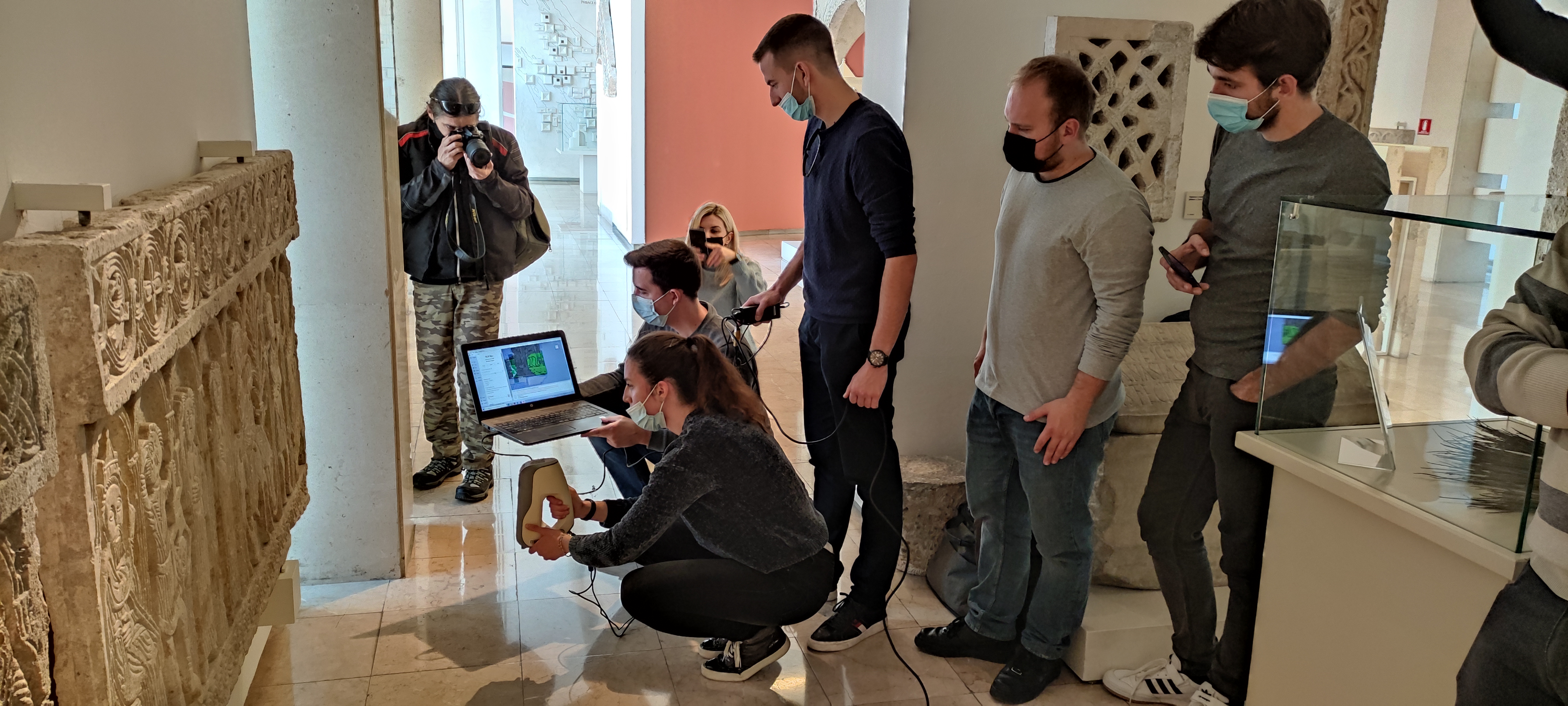
The importance of digital documentation of tangible cultural heritage is extremely important for professions such as archaeologists, geographers, curators and restorers. The applications of digital scanners are numerous. The primary purpose is digitization of cultural property as a form of preservation and protection of cultural property. The detail of the documentation of cultural property to optical scanners at the millimeter level allows the analysis of cultural property because it allows observing the changes that occur in the most valuable cultural monuments through the action of various influences. 3D models of cultural heritage are most often used to promote cultural content for tourism and educational purposes, most often in the form of virtual walks through cities or museums. The project involved second-year graduate students. Using high-precision handheld 3D scanners Artec Eva and Artec Spider, submillimeter-resolution 3D cork models were generated, which are the basis for cork protection and promotion. Also, the created models will be the basis for the analysis and classification of characters and scenes on cork, which can potentially lead to some new insights into the way cork is made and the artist's perception of biblical events depicted on the cork.
3D DOCUMENTATION OF MATERIAL CULTURAL HERITAGE
The importance of digital documentation of tangible cultural heritage is extremely important for professions such as archaeologists, geographers, curators and restorers. The applications of digital scanners are numerous. The primary purpose is digitization of cultural property as a form of preservation and protection of cultural property. The detail of the documentation of cultural property to optical scanners at the millimeter level allows the analysis of cultural property because it allows observing the changes that occur in the most valuable cultural monuments through the action of various influences. 3D models of cultural heritage are most often used to promote cultural content for tourism and educational purposes, most often in the form of virtual walks through cities or museums. The project involved second-year graduate students. Using high-precision handheld 3D scanners Artec Eva and Artec Spider, submillimeter-resolution 3D cork models were generated, which are the basis for cork protection and promotion. Also, the created models will be the basis for the analysis and classification of characters and scenes on cork, which can potentially lead to some new insights into the way cork is made and the artist's perception of biblical events depicted on the cork.